|
Kilmacoliver Loop, Co Kilkenny
Start and finish: 1km (half a mile) from Tullahought in southwest Kilkenny |
Kilkenny is perhaps one of the most blessed counties in Ireland. It has good land, excellent roads, abundant heritage, beautiful rivers and even a scattering of hills in the southern reaches of the county – not enough for adrenalin junkies, but there nonetheless.
Trail Kilkenny has established and maintains a selection of walking routes throughout the county. Last year, in response to increasing public interest, the group introduced trail apps for smartphones. The apps – available free from the Trail Kilkenny website – bring you on a guided tour of your selected route, highlighting points of interest adjacent to whatever location you are in along your chosen route.
Other useful information includes a list of local accommodation and, critically, sources of refreshment. The walks are well-maintained and waymarked and provide a safe, family-friendly environment for an outdoor experience.
We tested one of the walk apps at the Kilmacoliver Wood loop near the squeaky-clean village of Tullahought and just 25km (15½ miles) south of Kilkenny City. I said “tested” but it would be more honest to admit that, until this walk, I was a smartphone neanderthal and was depending on the expertise of others to bring me up to speed. A viewing tower has been built on an elevated site overlooking Tullahought which gives panoramic views of the countryside and has information plaques about the local area.
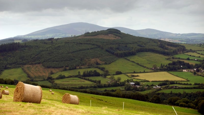
The trailhead is located in beautiful, rolling, pastoral countryside just over a kilometre from Tullahought. The first few kilometres are along metalled roads and lanes and provide a gentle warm-up for the rest of the walk. The first half of the route is uphill, so take it easy and enjoy your surroundings.
From the trailhead, proceed downhill for 400 metres (1,300 ft) to a lane on the left. Follow this lane for 2km (1¼ miles) as it makes its way uphill. Just past a metal gate entrance to an old homestead, the trail turns right and leaves the laneway to follow a ditch towards the summit of Kilmacoliver Hill. Cross stiles, follow the signs and check the app. Yes, you are there – the app says so and your eyes confirm this.
The summit of Kilmacoliver is used for grazing, and a herd of friesians was in situ when we arrived. In this environment, it is advisable to take great care where you place your feet – nature provides many hazards for the unwary walker.
There are good views from the summit, but on the day we were there a fine haze enveloped the countryside and limited the distance that we could see. At the summit, there is a circular arrangement of standing stones believed to be a megalithic tomb dating back 5,000 years.
Leaving the summit, the trail heads northwest and then north, following a wire fence on its descent. After nearly 2km (1¼ miles), the trail enters a privately developed woodland with stands of young oak, beech, larch, cherry and birch.
The trail continues up to a metal gate where you rejoin the laneway from the earlier part of your journey. Turn left to a T-junction and right to return to the trailhead.


