
Ireland has no truly pristine landscapes. Everywhere from brook to beach, mountain to marsh, hedge to heath is shaped in some way by human intervention. It is inescapable: wherever we wander, people have been there before, which means there are stories to uncover of heroism, endeavour, rebellion and sometimes tragedy. Below I have picked some of my favourite Irish walks that come with captivating tales of how human endeavour has shaped and sometimes been shaped by the Irish landscape.
Cave Hill, Co Antrim

The upward hike leads through natural woodlands and past brooding cliffs and ancient caves, before veering on to Cave Hill, where a clifftop path leads to McArt’s Fort. All of Belfast is now laid out below with views to Scotland and the Isle of Man on a clear day. But there is also a great backstory. To this redoubt, the leader of the United Irishmen, Theobald Wolfe Tone, came in 1795 and agreed a compact with a group of fellow radicals, including Thomas Russell and Henry Joy McCracken. Away from the prying eyes of British authorities, they promised “never to desist in our efforts until we had subverted the authority of England over our country, and asserted our independence”. They didn’t succeed, of course, but the seeds for an Irish republic had been sown.
Starting from Belfast Castle, a there-and-back walk to McArts Fort takes about 1½ hours
Slievenamon, Co Tipperary
The quintessential Tipperary mountain was where Thomas Francis Meagher came in 1848 to preach rebellion. Radical by nature, he had already gained the moniker “Meagher of the Sword” for his incendiary oratory. Journeying to France in 1848, he sought inspiration from a revolution that had recently installed a republican government. In Paris he was presented with an Irish flag based on the French tricolour that consisted of green, white and orange bars, symbolising peace between green and orange traditions. Initially flown from a window in Waterford, it was later unfurled by Meagher at the revolutionary meeting on Slievenamon before an estimated crowd of 50,000.
READ MORE


The subsequent Young Irelanders’ rebellion failed, with Meagher arrested and transported to Tasmania. In 1852 he escaped to New York, where he became a lawyer and then rose to the rank of brigadier-general in the US army, before drowning in mysterious circumstances on the Missouri river.
A there-and-back ascent of Slievenamon from above Kilcash village takes about 2½ hours
Stairway to Heaven, Co Fermanagh
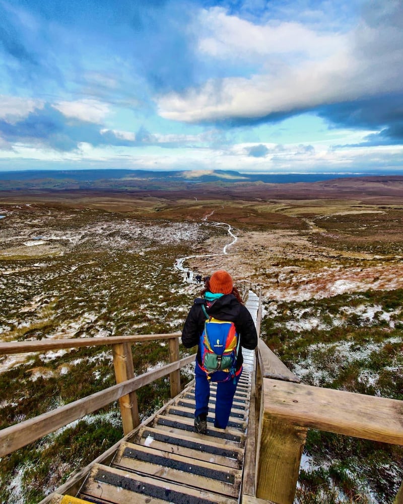
Cuilcagh Mountain, straddling counties Cavan and Fermanagh, is rarely classed among Ireland’s show-pony uplands. Its unexceptional footfall was, however, damaging a Special Area of Conservation that protected a fragile upland bog. To combat this, a 450-step wooden stairway was proposed about a decade ago.
Mountaineering Ireland had reservations but the stairway was accepted by Northern Ireland’s Environmental Agency, and the structure was completed in 2015. Nothing much happened until 2017, when a video titled “Stairway to Heaven” went viral. Immediately, an avalanche of walkers and sightseers alighted on the area, as overnight the Stairway became Fermanagh’s most popular attraction. The local council had accidentally created a huge attraction that continues to pull hordes of visitors to Lakeland County.
To complete the Stairway, head for Marble Arch Caves, Co Fermanagh. The trailhead is a short distance southwest along Marlbank Road. The there-and-back walk of the Stairway takes about three hours
Causeway Coast, Co Antrim

Battered by fierce Atlantic gales the Girona, a galleon of the Spanish Armada was forced to shelter at Killybegs in 1588. Meanwhile, other Armada ships were being battered to matchwood along Ireland’s unforgiving west coast. About 800 survivors from two shipwrecks made their way to Killybegs and boarded the Girona. Now with 1,300 men, the captain decided to head for Scotland, then an independent nation. Beyond Malin Head, a fierce gale hit the Girona and her rudder failed. Helpless as a drifting petal, she was blown on to rocks near the Giant’s Causeway with all on board perishing except for nine survivors. This sinking was recalled again in 1967 when a team of Belgian divers came to what had now become known as Port na Spaniagh. They discovered the ocean floor was littered with riches, including gold crosses, brooches, coins, silver candlesticks and gilded tableware. These now rest in the Ulster Museum.
Your one-hour walk starts from the Causeway Visitor Centre and follows the clifftop above the Giant’s Causeway to reach the Chimney Tops viewpoint. Beneath lies poignant Port na Spaniagh, where the Spanish went to a watery grave
Valentia Island, Co Kerry
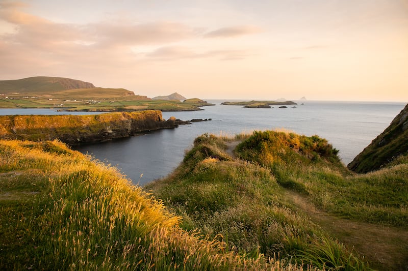
Once a remote island, Valentia became an epicentre of world communication when the first transatlantic telegraph was laid in the 1850s. An accident of geography made this the optimal place to run out the 1,686-mile cable to the deliciously named Hearts Content, Newfoundland. The initial communications occurred on August 16th, 1858, with a telegram of congratulations from Queen Victoria to US president James Buchanan welcoming “an additional link between the nations whose friendship is founded on common interest”. At Foilhommerum Bay a monument marks where the telegraph cable came ashore while the ruins of the cable station are visible nearby. It was from here that local nationalists, despite intense security, managed to forward a coded message to New York Republicans informing them of the 1916 Rising.
From Foilhommerum Bay, purple arrows lead gently uphill for about 30 minutes to reach Bray Head. Here, a signal tower atop vertiginous cliffs offers breathtaking views, particularly of the Skellig islands
The Silent Valley, Co Down

The rapid industrial expansion of Belfast during the 19th century put great pressure on water supplies. As a solution it was decided to build a huge reservoir in the Kilkeel Valley of the Mourne Mountains. A large tract of mountain was acquired and a 22-mile drystone wall was constructed to protect the water sources from contamination. Building the Silent Valley Reservoir began in 1923 and was finally completed in 1933 as Northern Ireland’s greatest engineering achievement.
Meanwhile, new techniques for water filtration rendered the Mourne Wall redundant, but it found another use. With the huge growth of hillwalking in the 1960s, the wall morphed into a valuable navigational guide for those ascending the highest peaks in the Mournes, while the Ben Crom Trail provides low-level access to the heart of the High Mournes.
For a memorable walk, follow the access road to Ben Crom for 5km until steps lead to a great viewpoint over water to Slieve Bearnagh and Meelmore. Admission to the Silent Valley, about four miles outside Kilkeel, costs £5 per vehicle
The Suir Blueway, Co Tipperary
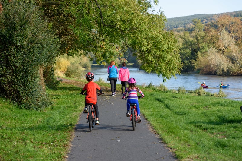
Before railways, water transport was the best way to move bulky goods. Navigable rivers were hugely important, and agricultural produce from rich heartlands such as Tipperary was routinely floated down the river Suir to Waterford. But what of sending goods upstream? Carrick-on-Suir was reachable but continuing to Clonmel was problematic. It involved teams of men laboriously hauling barges upstream. Eventually the idea was conceived of canalising the river Suir. A towpath was constructed in the latter part of the 18th century, along which horses pulled the barges.
The prosperous Davins of Carrick-on-Suir were alert to this and set up a successful river trading business. This allowed Maurice Davin (born 1842) the secure income to become a hugely successful athlete and achieve international fame by breaking several world records. He later attended the inaugural meeting of the GAA in Thurles and, as the highest-profile person present, became the first president of the new organisation.
In the 20th century the winds of change moved against river trading and the river Suir Navigation fell into disuse. Then, in a farsighted move, the towpath was officially reopened in 2019 as a 20km riverside walkway/cycleway.
For those wishing to cycle the Blueway, bikes can be hired from Blueway Bike Hire, Carrick-on-Suir
Gougane Barra, Co Cork
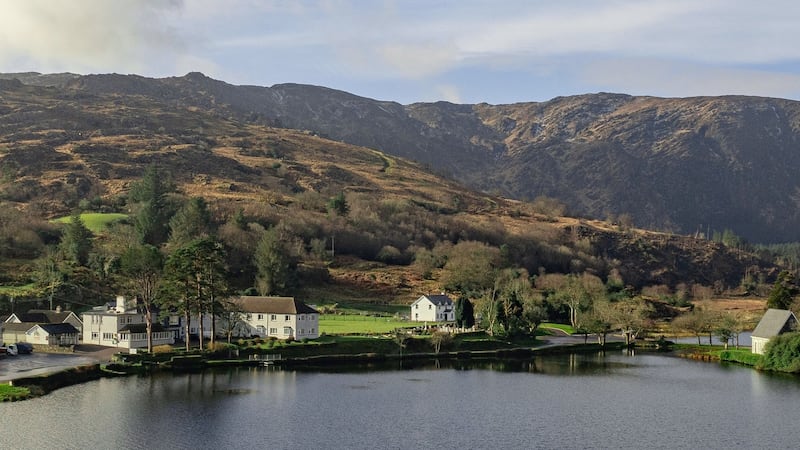
In 1921 Tom Barry’s west Cork flying column retreated into Cork’s Borlin Valley. In hot pursuit were thousands of British troops who had been deployed to eliminate the column, while more soldiers blockaded the escapes to Kerry. The situation seemed hopeless but Barry knew that if the Flying Column could reach Gougane Barra they would be outside the British encirclement. The problem was, however, that this involved crossing the Shehy Mountains at night and then descending 300m cliffs but there was no other option. Barry vividly recalled traversing the mountains in inky darkness and described volunteers slithering downwards on the cliffs using stretched-out rifles and improvised ropes. An hour later, “bruised and wrenched” but without serious injury, they reached the valley floor. Here it was an easy walk to the Gougane Barra Hotel safe in the knowledge they had escaped the British encirclement.
To visit the scene of Barry’s escape, start from the Gougane Barra Hotel, and continue by the lakeshore to the barrier, where cars pay a fee. Continue by the nascent river Lee and soon you will observe a steep gully high in the great cliffs above open ground. It was down this gully that the flying column escaped from the pursuing British troops
The Devil’s Bit, Co Tipperary
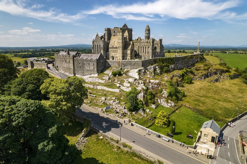
One of our most storied uplands carries tales of a demon fleeing St Patrick. The fiend created the famous Devil’s Bit by taking an angry bite from the mountain and then did a big service for Irish tourism by dropping it to form the Rock of Cashel. On the southern side of the mountain, an improbably located tower was built, for no apparent reason, by John Rutter Carden, better known as Woodcock. Carden, an unpopular local landlord, was so-called because, like a woodcock, he was difficult to shoot.
Aged 41 he became smitten with 18-year-old Elizabeth Arbuthnot, who lived near Clonmel, but his feelings were not reciprocated. Convinced Elizabeth was secretly infatuated with him, he attempted to kidnap her. The plan failed disastrously and he served two years in prison. Soon after his release, he built the extraordinary tower, which some locals believe was a monument to unrequited passion.
From the car park at Barnane Templemore, it takes about 90 minutes to complete the lovely Devil’s Bit Loop
Wild Stories from the Irish Uplands by John G O’Dwyer is published by Currach Books


