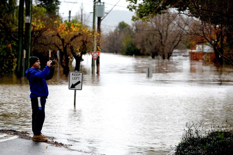
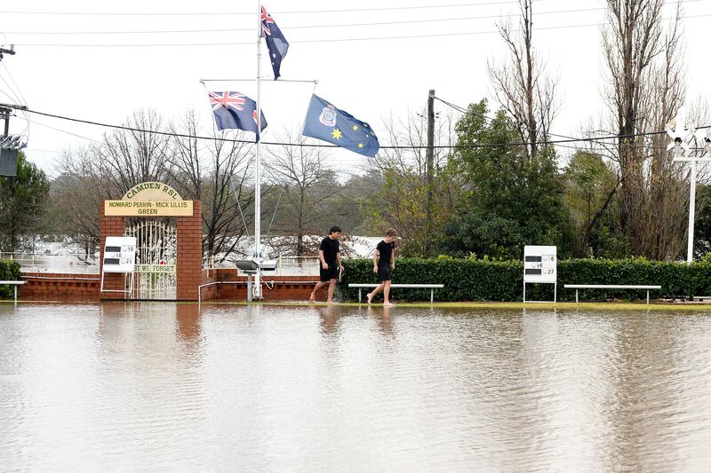
Sydney residents were warned of a “long night ahead” and another day of devastating flooding on Monday after large parts of the New South Wales coast were lashed with torrential rainfall on Sunday.
Thousands of people across the greater Sydney region were under evacuation orders on Sunday and more than 130 rescues took place as an east coast low, which is expected to persist until Tuesday, brought widespread rainfall, thunderstorms and flash flooding to parts of the state.
Authorities warned the impact could be more severe than the past three major weather events.
More than 40 evacuation orders and 44 evacuation warnings have been issued to communities in the greater Sydney region, while about 3,111 requests for assistance had been made to the State Emergency Service.
Residents were warned to delay non-essential travel in affected areas, potentially throwing the school holiday plans of thousands into chaos.

“If you were safe in 2021 do not assume you will be safe tonight,” the emergency services minister, Steph Cooke, said on Sunday evening, warning affected communities between Newcastle and Batemans Bay should reconsider travel plans.
“This is a rapidly evolving situation and we could see areas impacted that we haven’t seen before.
“It was a long night last night, it’s been a very long day today and tonight will be a long night for our emergency services [and] volunteers.”
The SES commissioner, Carlene York, said the situation could get “significantly worse” over the course of Sunday evening, affecting “hundreds to thousands” of homes.
“I don’t want to be reporting any loss of life,” she said.
Amid the extreme weather, a man drowned in the Parramatta River after a kayak capsized on Sunday afternoon.
Camden city council’s mayor, Therese Fedeli, spent Sunday afternoon looking at pictures of the rising flood waters on social media. She said it felt like watching a horror movie unfold.
“I’m devastated ... and you can’t get out there because you’re putting yourself in danger,” Ms Fedeli said.
Low-lying parts of Camden were issued with an evacuation warning early Sunday morning as flood waters continued to rise. An evacuation centre was quickly established at Narellan, 60km southwest of Sydney.
By 2.30pm, almost 20 roads were closed. Moderate flooding was continuing along the Nepean river at Camden Weir, sitting at 12.57m near its peak.
Ms Fedeli said her community was still reeling from two previous flood events this year, leaving the community feeling “numb”.
“When it’s all subsided you get out and the recovery comes in ... we’ve got to do it all again,” she said.
“We have businesses from the first time who just got the place repainted, get on their feet, get all excited with grand openings ... and now they’re back to square one.
“It’s heartbreaking for them ... how much can you take?”
‘This is not happening’
Ms Fedeli said the community had been preparing to evacuate since Friday but warned Sunday evening and Monday “wasn’t looking good”, with more rain forecast to hit.
“Sometimes you wish you could have a month’s warning,” she said. “We all thought, ‘oh my God, this is not happening’, but we got through it before and we’ll get through it again.
“All we’re concentrating on is keeping the community safe, closing those bridges and roads, getting people out.”
More than 30 evacuation orders were in place across the state covering parts of Camden, Menangle, Liverpool, Milperra, North Richmond, Wallacia, Penrith, Sackville, Upper Colo and Windsor.
Widespread rainfall in excess of 200mm had been recorded in parts of metropolitan Sydney in the 24 hours to 9am Sunday, with the heaviest falls around Newcastle. All dams were above 100 per cent capacity, while the Warragamba Dam was spilling at a rate of 500 gigalitres a day.
Patrick Conolly, a Hawkesbury city council councillor, said the Hawkesbury river was rising “quite quickly” on Sunday morning, much faster than previous estimates.
“We’re predicting a peak of 12.2m at Windsor tomorrow [Monday] ... subject to further rainfall,” he said.
By 3pm, the situation had worsened. The Bureau of Meteorology warned major flooding at North Richmond risked exceeding the March 2021, March 2022 and April 2022 flood events. The Hawkesbury river was expected to reach up to 15m on Sunday evening.
Major flooding continued along the Upper Nepean at Menangle, peaking just shy of the April 2022 flood height at 16.83m. At Penrith, the Nepean reached 9.2m, with further rises possible depending on rainfall.
Spills from the rising Warragamba Dam, combined with inflows from the upper Nepean river, were expected to cause major flooding at Windsor well into Monday, also exceeding the past three major flood events.
On Sunday afternoon, the Windsor and North Richmond bridges were closed, dividing the community between the east and west side of the river. Further evacuation warnings were issued for low-lying communities as the pelt continued.

Preparation and fatigue
“There’s a mixture of preparation and fatigue,” Mr Conolly said.
“You’re frustrated and exhausted [that] it’s happening again but there’s also much greater awareness. People are more educated on what flood height will affect them and what won’t.”
Mr Conolly said the community had only finished dropping off flood waste from the April flooding event days ago. All recovery centres had been open until early June.
“Private property owners still have work to do, we still have roads not prepared from prior floods,” he said. “It may take many months. We have to hope for the best.”
A severe weather warning remained current for Sydney, Illawarra and parts of the Hunter and Central Tablelands on Sunday afternoon, with saturated soil at risk of flash flooding, riverine flooding and coastal erosion.
The New South Wales State Emergency Service has responded to more than 1,800 requests for assistance and conducted 83 flood rescues.
The Bureau of Meteorology’s Jane Golding said the east coast low was expected to cross the coast on Sunday evening, bringing the “rapid intensification” of rainfall in the Hunter, Sydney, the Blue Mountains and Illawarra districts.
Six-hourly rainfall of up to 120mm was possible on Sunday evening for affected areas, with damaging winds in excess of 90km/h and peak wave heights.
Heavy, hazardous surf driven by onshore winds were expected to continue until weather eased on Monday afternoon, with wave heights of more than 5m recorded at the Sydney wave buoy, and gusty winds expected to bring town trees and power lines.
Geoff Gardner, a retiree, was holed up in his home at Bawley Point on the Shoalhaven, where rainfall in excess of 300mm had been recorded in some parts.
A popular holiday destination, the region was still reeling from the 2019/2020 bushfires that had swept along the coastline, burning half a million hectares.
“Seven and a half inches of rain were detected here on Friday,” Mr Gardner said. “Lake Willinga burst open into the sea. Water is cascading metres wide.” — Guardian
(c) Copyright Thomson Reuters 2022


