

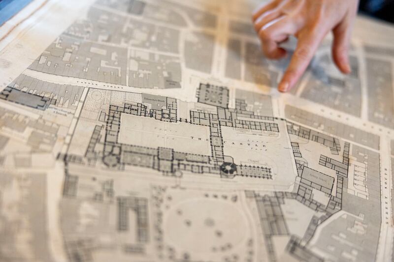
In 1824, teams of surveyors began to map Ireland, making it the first place in the world to have detailed ordnance survey maps for an entire country.
Now, 200 years later, these 6in to a mile maps, books of placenames, memoirs and letters have been brought together in an open-access digital archive for researchers and members of the public.
An exhibition of information panels explaining the work involved in the three-year-long Digitally Remapping Ireland’s ordnance survey Heritage OS200 project can be seen in the Royal Irish Academy library, Dawson Street, Dublin, where much of the original archival materials are housed.
“The project has reconnected original sources that were always intended to be together. It will give us a detailed picture of what life was like in town lands across Ireland in terms of agriculture, population, wealth, antiquities and folklore,” explains Dr Keith Lilley, professor of historical geography in the School of Natural and Built Environment at Queen’s University Belfast.


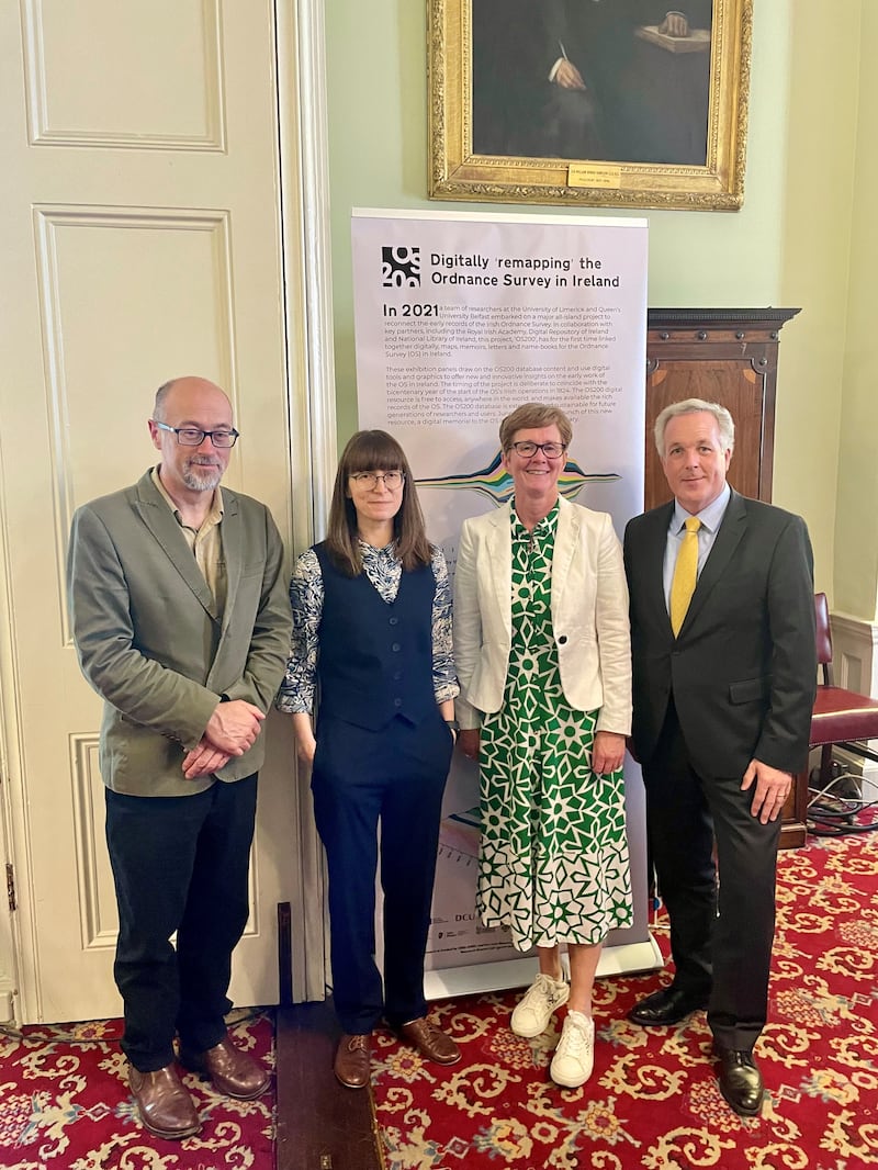
Lilley is one of the principal investigators on the OS200 project, jointly funded by the Irish Research Council and the British Arts and Humanities Research Council.
Dr Catherine Porter, associate professor of geography at the University of Limerick, the second principal investigator, believes members of the public will use the online resource to trace old homesteads and townlands where past generations lived.
“When I look at a map, I look at where I’m from and what it shows me about that place in the past and I think this will be of great interest,” she explains.
The memoirs – written by surveyors mapping the country North to South over 15-20 years – add valuable information about family names, migration records and even names of people on headstones in local graveyards. The new digital archive gives people access to the full set of these memoirs for the first time.
“It will allow researchers to uncover otherwise hidden and forgotten aspects of life and work of those employed by the ordnance survey and to explore the island’s complex colonial histories, facilitating additional understanding of pre-famine Irish history,” adds Dr Porter.
The ordnance survey teams, led by Col Thomas Colby, mapped 60,000 townlands systematically from North to South into a total of 1907 map sheets. Coping with various weather conditions, local curiosity and sometimes resistance, roads, settlements, bogs and loughs were all accurately surveyed in the field.
The memoirs of surveyors sometimes included sketches of buildings and monuments, many of which no longer exist, allowing researchers now to reimagine what was once there.
One of the most significant outcomes of these first surveys was the engraving on maps of thousands of Irish placenames in anglicised forms which were recorded in pocket-sized namebooks.
Given that the population of at least half the country was Irish-speaking at the time and that many placenames had never been written down in any language, the gathering of thousands of historical forms of placenames extracted from Irish, Latin and English sources as well as local knowledge was a mammoth task.
Irish language scholar, John O’Donovan – who became professor of Celtic Languages at Queen’s University Belfast – was a key researcher into placenames at the time.
And while studying the historical geography in and of itself is central to the OS200 project, researchers will also be able to draw comparisons to contemporary maps – in particular the new national land cover map, recently completed by Tailte Éireann [where Ordnance Survey Ireland now sits] and the Environmental Protection Agency (EPA).
Lilley suggests, for example, the original ordnance survey maps and the memoirs carry important information about the distribution of bogs across the country. “We will be able to mine these data sets now to see to what extent we have lost bogs and other kinds of land cover. This will be of great scientific value to peatlands researchers,” he says.
Arguably, such information could inform which peatlands are chosen for habitat restoration as part of Ireland’s commitments to the EU Nature Restoration Law.
Other information such as the course of rivers could also be useful as townland boundaries in the original ordnance survey maps followed the course of a river while more recent townland boundaries follow the course of rivers some of which were later straightened for agricultural purposes. With a new understanding of how re-wiggling rivers can slow down the passage of water to prevent flooding of urban areas downriver, such information about the earlier flow of rivers could be very useful.
“The common denominator between the historic and modern data is that it all has geospatial references so researchers will be able to make comparisons between the past and the present on the characteristics of townlands,” Lilley adds.
Members of the public can still consult the original bound books of ordnance survey maps in the Royal Irish Academy (RIA) with the assistance of the librarians there.
“We also have 50 boxes of memoirs that we received through donations from the Ordnance Survey Ireland in the Phoenix Park and from surveyors who were members of the RIA,” says Barbara McCormack, librarian at the RIA.
“The OS200 project is building on what was there already. But it’s technically more sophisticated so that people can dig deeper into information behind the maps,” explains Sarah Gearty, who works with the Irish Historic Towns Atlas at the RIA.
Meanwhile, the recently completed detailed national land-cover maps are already being used by the EPA and other official bodies for everything from water quality management to improved mapping of tree lines/canopy cover and hedgerows with potential future use in classifying bath water profiles and mapping future land use.
The national landcover map was produced by Tailte Éireann and the EPA using an innovative mapping methodology designed to enable the two organisations to classify over 10 million land cover features in the landscape. These include four different types of grassland (amenity grassland, wet grassland, dry grassland and improved grassland). Similarly, forests are subdivided into mixed forest, broadleaved forest and woodland, transitional forest, coniferous forest and treelines.
“With this level of detail and data that is specific to Irish landscapes, the national landcover map will fundamentally change our understanding of land status in Ireland,” says a spokesperson for Tailte Éireann.
Mapping Ireland Through Time: from cartographies to communities is a public event at 6pm on Tuesday, August 27th, at the Royal Irish Academy. Held in partnership with the International Geographical Congress 2024, it will look at the evolution of map-making in Ireland from a colonial project to contemporary community map-making. A Digital Archive of Ireland’s Ordnance Survey is available on dri.ie
- Sign up for push alerts and have the best news, analysis and comment delivered directly to your phone
- Join The Irish Times on WhatsApp and stay up to date
- Listen to our Inside Politics podcast for the best political chat and analysis


