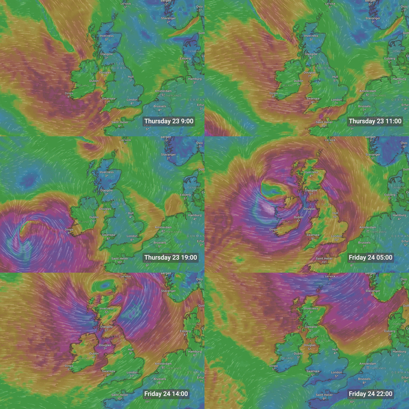
Schools, crèches and third-level institutions will remain closed on Friday, with public transport curtailed as the country braces itself for Storm Éowyn.
The public have been warned to take shelter, avoid unnecessary journeys and not to approach coastlines while red weather warnings are in place.
ESB Networks said extensive damage to electricity infrastructure is anticipated, as are widespread power outages, which could take “a significant number of days” to restore. Many businesses and retailers will also remain shut for the duration of the storm.
A red wind warning – the highest alert level – was due to come into effect across the country during the early hours of Friday morning, and is in place until 2pm for some counties. Gusts in excess of 130km/h are expected.
READ MORE
Keith Leonard, the chair of the National Emergency Co-ordination Group, said on Thursday: “Public safety is our core objective for the next 24 hours. The key message remains that people need to shelter in place.
“This is among the most dangerous storms that Ireland will have faced ... We’re going to see a huge number of trees down tomorrow and a lot of people are going to be without electricity, broadband, water supplies.”
[ Storm Éowyn preparations: How the day before the storm unfoldedOpens in new window ]
Met Éireann’s deputy head of forecasting Liz Coleman said the damaging gusts would cause dangerous travelling conditions on Friday, with the likelihood of fallen trees and power outages.
“Wave overtopping is also expected at high tide. There could be localised flooding further into Saturday associated to the heavy rain and to the snow melt,” she said.
“Western and northwestern counties are likely to see status-orange wind warnings as a minimum [on Saturday], but we are monitoring the situation closely and will issue warnings as Met Éireann’s high-resolution model, which provides information two days ahead, comes into play ... There will be a short respite from the weather on Saturday as Éowyn moves away, but we are also watching a different low-pressure system, forecast to bring impactful winds and further rain on Sunday.”

Disruption is expected to incoming and outgoing flights at various airports around the country, with customers advised to check with their airline.
Irish Rail said there would be no rail services anywhere on its network on Friday morning and for the duration of the red warnings. This includes intercity, Dart and commuter services.
Bus Éireann, Dublin Bus, GoAhead and Luas services will also not operate during the warnings.
The Road Safety Authority said it was “not a typical weather event” and had the potential to be “a significant and historic storm that poses a serious risk to life”.
“Everyone must act responsibly to protect themselves and others while reducing pressure on emergency services and crews, who will be dealing with and responding to the aftermath of this extremely dangerous and destructive storm,” it said. “If travel is not essential, stay indoors, secure property and avoid unnecessary risks.”

Met Éireann’s red wind warnings come into effect in Carlow, Kilkenny, Wexford, Cork, Kerry, Limerick and Waterford at 2am on Friday and will last until 10am.
In Clare and Galway, the warning runs from 3am until 11am while in Leitrim, Mayo and Sligo, it is in place between 4am and noon.
In Cavan, Monaghan, Dublin, Kildare, Laois, Longford, Louth, Meath, Offaly, Westmeath, Wicklow, Roscommon and Tipperary, the warning will extend from 6am to 11am.
In Donegal, the warning will be valid from 7am to 2pm. An orange wind warning is also in place across the entire country from midnight until 4pm on Friday.
The UK Met Office has also issued a red wind warning for Armagh, Down, Antrim, Tyrone and Fermanagh between 7am and 2pm.
The last time Met Éireann issued red weather warnings was during Storm Emma in 2018 and Storm Ophelia in 2017.
Meanwhile, a means-tested funding scheme for people whose homes are damaged from flooding and severe weather events will be available to people impacted by Storm Éowyn, Minister for Social Protection Dara Calleary confirmed on Thursday night.
The Humanitarian Assistance Scheme provides income-tested financial support to people whose homes are damaged from flooding and severe weather events, and who are unable to meet costs for essential needs, household items and structural repair.
Stage one of the scheme provides emergency support payments for food, clothing and personal items in the immediate aftermath of an event, while stage two involves the replacement of white goods, basic furniture items, and other essential household items.
Stage three of the scheme identifies what longer term financial support is required, including plastering, dry-lining, relaying of floors, electrical re-wiring and painting.
- Sign up for push alerts and have the best news, analysis and comment delivered directly to your phone
- Join The Irish Times on WhatsApp and stay up to date
- Listen to our Inside Politics podcast for the best political chat and analysis


