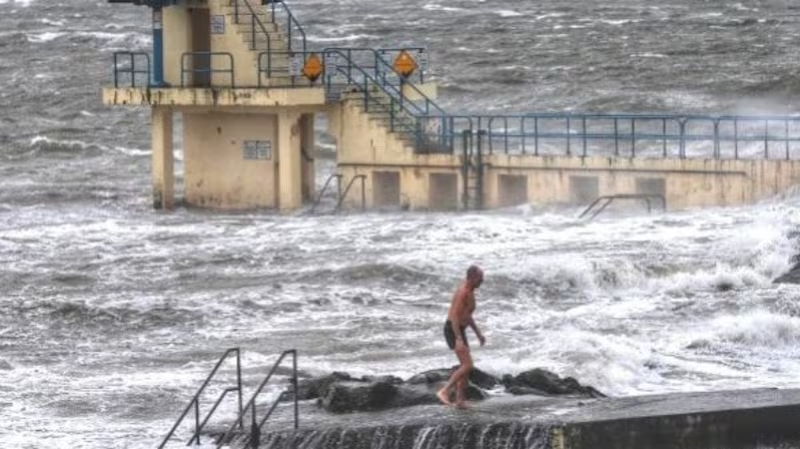
The consequences of Storm Jorge will be felt in the coming week as the heavy rain fall over the weekend result in an increased flood risk in areas close to rivers.
The stormy weather brought with it severe winds and heavy rain on Friday and Saturday, particularly in the West of the country. The weather is turning cold on Sunday night with a status yellow snow/ice warning in place for the entire country until 8am on Monday.

As Storm Jorge approached on Saturday, a status red wind warning was in place for Galway and Clare on Saturday morning and afternoon. Orange and yellow alerts were put in place in place for much of the country until midnight.
Approximately 20 to 30mm of rain fell over the two days, which still has to filter down into the rivers, making flood risks high, said Met Éireann forecaster Joan Blackburn.
“It wouldn’t be considered high rainfall but we have the discretion to issue them [WARNINGS]when it could be impactful i.e. the rivers were high,” she said.
“This is another 20 or 30mm flowing into the rivers from all of the lands, so that’s quite a quantity of water. The flooding is often after the event.”
She added: “A lot of rivers take awhile for the rainfall to sort of filter down and actually flood. Basically, rivers in Connaught, in the Midlands and Clare, they’re still at danger levels. And that rainfall still has to filter down through.”
Pádraig Cunniffe, a farmer in Newtownflood, near the River Shannon, said the water on his lands had risen by about a foot over the past week.
“We can’t even get down the road to the lands in our car anymore, we have to try and use a tractor,” Mr Cunniffe said. “It’s putting extra hardship on everyone and we just don’t know when it will stop.”
“My neighbour had to move his cattle because his shed is flooded. All his timber and turf is floating in the water now. My shed is ok at the minute but if the rain continues, it will be flooded too.”
The stormy conditions also left thousands of properties without power but most of of these were restored before Sunday morning.
A number of trees fell on roads which were later cleared and gardaí said nobody was injured when a truck overturned in high winds in Co Galway on Saturday afternoon. The Irish Coastguard Sligo helicopter rescued two surfers that go into difficulties in on Saturday afternoon.
The early days of next week are forecasted to be unsettled and rainfall is forecasted to be above average across most of the country.

“Rainfall accumulations may be as much as one-and-a-half to twice the normal except along eastern coastal areas, which will see below average rainfall,” the forecast says.
“However, as river levels remain elevated and soils waterlogged any further rainfalls this week will add to the risk of flooding.” Ms Blackburn also said it is going to be a very cold week.
“The precipitation is going to be in the form of showers, hail and rain showers and some sleet and snow showers at times as well,” Ms Blackburn said.
“The overall amount of rain you could get covering a province would be less than if it’s a band of rain. You could get very heavy showers but you still won’t have the quantity of rain coming through feeding into the rivers.”
The weather will turn wetter on Friday, when an Atlantic frontal system moves in, bringing less cold air, but heavier rain.
A number of roads that were flooded last week remained closed on Sunday. In Tipperary the Nenagh/Terryglass Road (R493) is closed at Ballinderry due to flooding while the N65 is closed between Portumna in Galway and Borrisokane near the turn-off for Terryglass (R493) in Tipperary due to flooding and diversions are in place. AA Roadwatch said flooding had also caused the Borrisokane/Cloghan Road (R438)to close between the Portumna turn-off at Walsh Park Cross and the Banagher turn-off at Taylor's Cross.


