Teagasc is using spatial analysis to help farmers achieve higher outputs and improved environmental standards as well as to provide evidence-based knowledge to support policymakers in designing, implementing and evaluating programmes.
Taking data from a variety of sources including the Ordnance Survey of Ireland, the Central Statistics Office, and Earth observation satellites, and remote sensing technologies, the Teagasc spatial analysis unit has created a powerful platform for the comprehensive analysis of all land-based activities at the interface between the agrifood sector, economy and environment.
“The unit was established in 1998 as part of the Irish Forest Soils project, with one of the first outputs being the indicative soils map of Ireland,” explains Teagasc data technologist Jesko Zimmermann. “Soils are such an intrinsic spatial property of land. Spatial analysis helps farmers know where they are at in terms of their land.”
Soil quality is also directly linked to how greenhouse gases are released from land, he notes.
The traditional method of soil mapping is to go out and take sample cores, but that would be far too expensive and labour intensive to do nationally. That’s where spatial analysis comes in. By identifying the various factors that influence soil quality it is possible to infer soil types nationwide.
“Lots of factors including climate, topography, height, elevation, and slope define what you can do with land,” says Zimmermann.
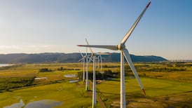
A practical example of the unit’s work is a project which is seeking to use satellite images to determine biomass in paddocks. Instead of a farmer having to go out every day with a grass meter to decide when to cut, when to fertilise, when to put animals into a field and so on, the data might be supplied on a phone app.
A project, co-funded by Microsoft, is exploring how internet of things (IoT) and AI technology can be applied to the land-based aspect of greenhouse gas emissions. Terrain AI will focus on improving understanding of the impact of human activity on land use and how it relates to climate change. The research will initially focus on test sites in Ireland, with the ultimate aim of reducing global carbon levels by sharing the insights and models developed with other countries.
Fertiliser costs
“There is a very strong link between land use and greenhouse gas emissions,” Zimmermann explains. “Spatial analysis can help guide farmers with more targeted and effective fertiliser application, for example. This helps the environment and helps farmers economically as well by reducing fertiliser costs. If you know the soil type you can help the farmer manage land optimally.”
The unit’s work has led to the production of the popular Teagasc “map of the month” series. These maps offer visual representations of a range of agricultural, social, economic and cultural issues with the most recent one highlighting locations around Ireland associated with St Patrick.
“One of the maps shows commuter distances along major road arteries,” Zimmermann adds. “It shows that areas with direct links to major arteries tend to have less local employment. Location has cultural connotations as well. We did a map last year showing how agriculture has influenced place names like Clontarf in Dublin for example. Spatial analysis brings a lot of different aspects together to create new knowledge.”
Travel limits
In June 2020 the unit produced a visual representation of the effects of that year’s spring drought and its implications for agriculture. “There was virtually no rain during the main planting period,” Zimmermann points out. “Our spatial analysis showed that it didn’t hit all parts of the country in the same way. Some places were hit harder than others. And places with heavier soils which retained more water had even higher production in some cases.”
The maps have also addressed the Covid-19 pandemic. One map looked at the impact of the 2km travel limit on isolated areas of the country. Another looked at the distribution of populations at higher risk from the virus.
The changing nature of agriculture around the country over the years has also been revealed. “We did a map showing the arable agriculture associations with townland names. This shows how agriculture has changed over the years. Arable farming was much more widely spread than today with many placenames in the west of Ireland associated with it. It is now confined mainly to the southeast of the country.
“What a graph is to data analysts a map is to spatial analysts,” he concludes. “We are looking to tell a story. They say a picture paints a thousand words, and we tell a specific story with a map.”